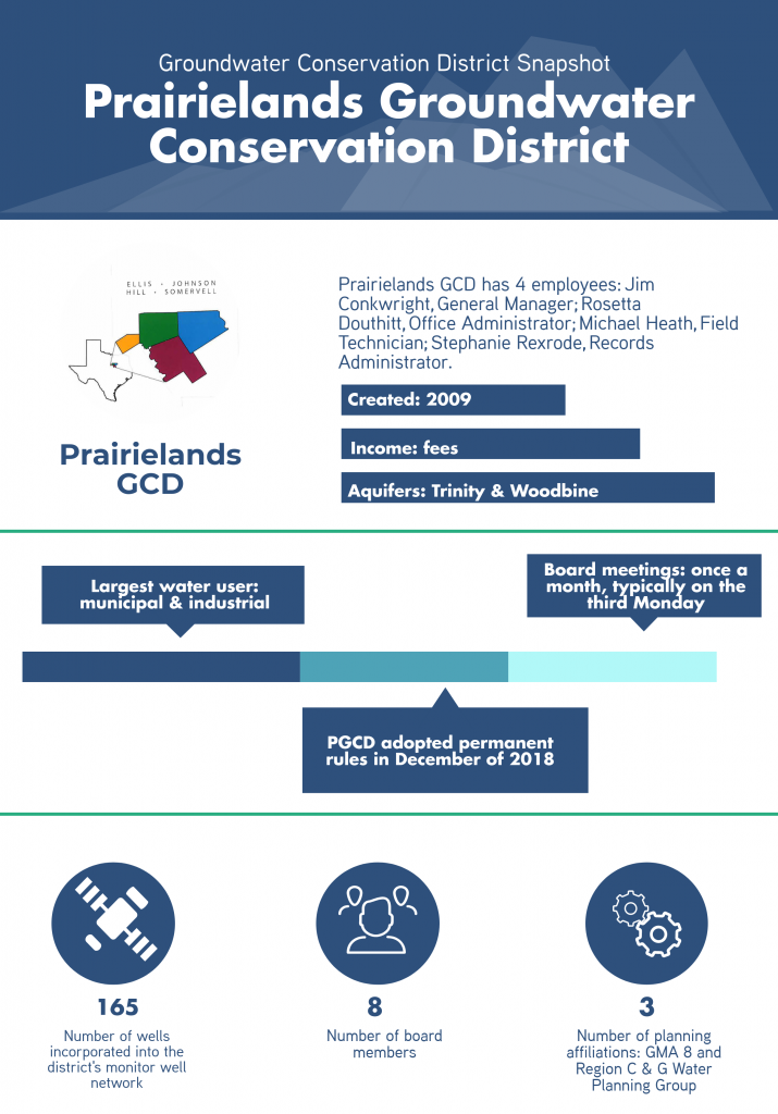
Prairielands GCD
Rules
Prairielands Groundwater Conservation District (PGCD) adopted permanent rules in December of 2018. TAGD sat down with PGCD to learn more about the rule adoption process, and is sharing some of the takeaways with you here.
TAGD: Describe the process the district went through in developing rules.
PGCD: The district began the process of developing permanent rules by holding meetings with staff, legal counsel, a hydrologist, and members of the Rules and Bylaws Committee. This committee is comprised of one Director from each county in the district. In order to engage members of the public and solicit input on potential rules, PGCD held several stakeholder meetings inviting members of the industrial, manufacturing, public water supply, and municipal sector to participate. Following the series of stakeholder meetings, PGCD sent letters to every non-exempt well owner in the district. The potential new rules were discussed at district board meetings for over a year before being adopted.
TAGD: How long did the rulemaking process take?
PGCD: The process took more than 2 years from start to finish.
TAGD: What were the primary objectives as the rules were being designed?
PGCD: PGCD is committed to working with its stakeholders to ensure a sustainable, high-quality, and cost-effective supply of groundwater. In order to ensure such a supply, the district’s primary objectives in designing permanent rules was to:
- Provide protection to existing wells
- Prevent waste
- Provide a framework that will allow for availability and accessibility of groundwater for future generations
- Promote conservation
- Limiting competition between wells utilizing minimum tract size and spacing requirements
- Respect of private property rights and honoring investment backed expectations
- Operate the district in a fair and equitable manner for all residents of the District
TAGD: What projects and scientific studies were undertaken to inform the district’s rules?
PGCD: The district’s hydrologist completed several rules assessments, including minimum tract size study and spacing requirement studies. Over the past five years, PGCD has also contributed to GMA 8 planning and the Northern Trinity and Woodbine Aquifer Groundwater Availability Model (GAM), both of which served to increase the district’s knowledge of local hydrogeology and in turn inform district rules.
Permitting
TAGD: Could you describe your permitting approach?
PGCD: The district adopted a permitting approach that utilizes historic use, but which also allows for growth using operating permits. Under district rules, historic use permits for existing wells are calculated by taking into account the greatest use in a single 12-month period over the past 15 years and turning that into a maximum production rate. All new non-exempt wells will have operating permits, however, a historic user may apply for an operating permit if the applicant needs more water in the future. Operating permits are based on contiguous controlled acreage.
Quick look at permitting rules in PGCD
- Max production rate: no maximum as long as well meets spacing requirements
- Spacing requirements: non-exempt wells spacing requirements are based on a formula that considers specific aquifer characteristics at the well site
- Link to rules: click here
- Pre-application meeting: for non-exempt permits, all applicants will participate in a pre-application meeting to help guide them through the application process
District Programs
Monitor Well Network
TAGD: Where is PGCD in its effort to build out a monitor well network?
PGCD: PGCD currently has 165 wells incorporated into the groundwater monitoring network. Of this total, 148 wells are observation wells and the water levels are read annually, at a minimum and several are read more frequently. We have increased the number of observation wells by almost 30% since 2017. Additionally, the district has 17 monitor wells. Several of these wells are equipped with Wellntel groundwater-level sensors, providing real time data for the district and for the well owner. This is a valuable tool, increasing constituent interest through their being able to monitor seasonal trends and gain other information from the observation of their own well.
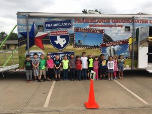
Educational Trailer
 TAGD: How long have you had your educational trailer?
PGCD: The district has had the trailer since 2013. The main purpose is for educational and public outreach and it can be found at schools, civic, and community events throughout the district.
TAGD: How many visitors have come through the trailer?
PGCD: In 2017 the trailer saw about 2,300 visitors in its trips across the district.
Helpful Resources
Visit PGCD’s website at prairielandsgcd.org.