Monthly Feature
Middle Pecos Groundwater Conservation District
Tools & Technologies
Middle Pecos GCD uses multiple technologies to keep track of their 100+ monitoring wells. In fact, 25 of the monitoring wells have telemetry tools, like transducers or a GS 93 float help track the wells’ static water levels. Each monitoring well is also equipped with a rain gage, so one well site provides a wealth of information to the district and landowner. Other field equipment employed includes a GPS unit and an E-line for measuring water levels.
In addition to telemetry tools, the Middle Pecos GCD uses ArcGIS and LeapFrog for mapping and modeling. To further their understand of that mapping and modeling, the district contracted Allan Standen to create two models for them: one that maps water from the surface to 13,000 feet and another that maps injection wells and saltwater disposal wells in the district. There is a high level of oil and gas activity within the boundaries of the district, including over 3,000 injection wells and 50 saltwater disposal wells.
Permit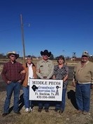 ting
ting
There are over 3,000 registered wells in the district, of which over 2,000 are exempt. Any well that exceeds 17.5 gallons per minute is considered non-exempt and will require a permit issued by Middle Pecos GCD. The varying conditions in the aquifers located within the district mean average well yields can vary from 400 gallons per minute (GPM) to 3,000 GPM. Middle Pecos GCD has issued four export permits covering 18 wells for groundwater to leave the district boundaries. In fact, it just issued an export permit for 10,000 ac/ft last year. In order to qualify for an export permit, the application must be deemed by the Middle Pecos GCD Board to have no adverse impact on the aquifer.
GCD Programs
Scholarship Contest
Middle Pecos GCD has three school districts within their jurisdiction, which include Fort Stockton, Imperial and Iraan. In 2016, the district started an essay contest to give high school seniors a chance to learn more about groundwater and earn a $1,000 scholarship. Students are tasked with writing an essay about groundwater. Subtopics can include the United States Geological Survey (USGS), the Texas Commission on Environmental Quality (TCEQ), the Railroad Commission (RRC), or the Texas Water Code (TWC).
Mapping Comanche Springs
One of Middle Pecos GCD’s currently evolving program is a project mapping the route of Comanche Springs above ground. Comanche Spring flows for several months in a year when adequate rainfall occurs. The mapping project will include placing informational signs on the land surface following the spring’s trail to educate residents about the underground spring formation.
Free Water Analysis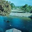
Water samples are taken at multiple locations during the summer months by the Middle Pecos GCD field technician. This sampling helps the district and the landowner know more about water quality in particular areas. A water sample is also taken for every newly drilled well. Members of the general public can also bring in samples from their home or business and have it tested free of charge.
Challenges
One of the challenges Middle Pecos GCD faces relates to brackish groundwater zones. Both the classification and determination of jurisdiction of these zones is challenging within a hydrogeologically diverse area. Additional challenges include continual monitoring of the 50 oil and gas production salt disposal wells for groundwater contamination.
Helpful Resources
Find the latest Middle Pecos GCD happenings by visiting http://www.middlepecosgcd.org/.